UN
9 Lees Lane
£ 90,000
Description
We don't have a Description for this property.
- Bedrooms
- 1
- Bathrooms
- 0
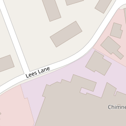

Leaflet © OpenStreetMap contributors
The heatmap indicates the level of crime in the area. The color of the heatmap indicates the crime severity and recency.
Metrics Year-on-Year
- Average area value
- 248,860.00 £Increased by 17.71 %
- Average area rental value
- 1,116.00 £/moIncreased by 11.82 %
- Est rental Yield
- 5.38 %Decreased by 4.95 %
- Crime Rate
- 12.00 %Unchanged by 0.00 %
from 211,426.00 £
from 998.00 £/mo
from 5.66 %
from 12.00 %
Nearby Schools
| Name | Type | Ofsted | Distance |
|---|---|---|---|
| Leesland Church Of England Controlled Infant School | Voluntary Controlled School | Good | 0.49 KM |
| Leesland Church Of England Controlled Junior School | Voluntary Controlled School | Good | 0.54 KM |
| Oarsome Chance | Special Post 16 Institution | 0.58 KM | |
| St Vincent College | Academy 16-19 Converter | Good | 0.58 KM |
| Little Waves Children'S Centre | Children's Centre Linked Site | 0.62 KM |
Images
Nearby Streets
| Name | Average Price | Average Sqft | Distance |
|---|---|---|---|
| Reed's Place | £ 190,000 | 0 | 0.00 KM |
| Mill Pond Road | £ 225,000 | 0 | 0.00 KM |
| Lee Road | £ 0 | 0 | 0.00 KM |
| Neville Court | £ 0 | 0 | 0.00 KM |
| Bury Close | £ 335,000 | 0 | 0.00 KM |
Nearby Transport
| Name | NLC | TLC | Distance |
|---|---|---|---|
| Portsmouth Harbour | 5540 | PMH | 3.73 KM |
| Portsmouth And Southsea | 5537 | PMS | 5.59 KM |
| Portchester | 5928 | PTC | 5.81 KM |
| Ryde Pier Head | 5541 | RYP | 7.02 KM |
| Fratton | 5509 | FTN | 7.47 KM |
Nearby Listings
| Address | Price | Type | Score | Distance |
|---|---|---|---|---|
| Lees Lane, Gosport, Hampshire | £ 125,000 | BUY | 5 / 10 | 0.01 KM |
| Forton Road, Gosport | £ 170,000 | BUY | Unknown | 0.14 KM |
| Bartons Court, Forton Road, Gosport, Hampshire, PO12 | £ 140,000 | BUY | Unknown | 0.14 KM |
| Forton Road, Gosport | £ 90,000 | BUY | 4 / 10 | 0.14 KM |
| Whiteacres Close, Gosport, Hampshire, PO12 | £ 130,000 | BUY | 5 / 10 | 0.15 KM |
Nearby Properties
| Address | Price | Distance |
|---|---|---|
| 9 Lees Lane | £ 90,000 | 0.00 KM |
| 22 Lees Lane | £ 120,000 | 0.00 KM |
| Burnside | £ 190,000 | 0.00 KM |
| 23 Lees Lane | £ 130,000 | 0.00 KM |
| 19 Lees Lane | £ 130,000 | 0.00 KM |